A set of maps created by the University of Sheffield have illustrated, for the first time, how our last British ice sheet shrunk during the Ice Age.
Led by Professor Chris Clark from the University's Department of Geography, a team of experts developed the maps to understand what effect the current shrinking of ice sheets in parts of the Antarctic and Greenland will have on the speed of sea level rise.
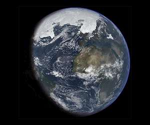
The unique maps record the pattern and speed of shrinkage of the large ice sheet that covered the British Isles during the last Ice Age, approximately 20,000 years ago. The sheet, which subsumed most of Britain, Ireland and the North Sea, had an ice volume sufficient to raise global sea level by around 2.5 metres when it melted.
Using the maps, researchers will be able to understand the mechanisms and rate of change of ice sheet retreat, allowing them to make predictions for our polar regions, whose ice sheets appear to be melting as a result of temperature increases in the air and oceans.
The maps are based on new information on glacial landforms, such as moraines and drumlins, which were discovered using new technology such as remote sensing data that is able to image the land surface and seafloor at unprecedented resolutions.
Experts combined this new information with that from fieldwork, some of it dating back to the nineteenth century, to produce the final maps of retreat.
It is also possible to use the maps to reveal exactly when land became exposed from beneath the ice and was available for colonisation and use by plants, animals and humans. This provides the opportunity for viewers to pinpoint when their town/region emerged.
Professor Chris Clark, from the University of Sheffield's Department of Geography, said: "It took us over 10 years to gather all the information in order to produce these maps, and we are delighted with the results.
"It is great to be able to visualise the ice sheet and notice that retreat speeds up and slows down, and it is vital of course that we learn exactly why. With such understanding we will be able to better predict ice losses in Greenland and Antarctica.
"In our next phase of work we hope to really tighten up on the timing and rates of retreat in more detail, by dropping tethered corers from a ship to extract seafloor sediments that can be radiocarbon dated."
earlier related report
Polar Bear Births Could Plummet With Climate Change
University of Alberta researchers Peter Molnar, Andrew Derocher and Mark Lewis studied the reproductive ecology of polar bears in Hudson Bay and have linked declining litter sizes with loss of sea ice.
The researchers say projected reductions in the number of newborn cubs is a significant threat to the western Hudson Bay polar-bear population, and if climate change continues unabated the viability of the species across much of the Arctic will be in question.
Using data collected since the 1990s researchers looked at the changing length of time Hudson Bay is frozen over (the polar bear's hunting season) and the amount of energy pregnant females can store up before hibernation and birthing.
An early spring-ice breakup reduces the hunting season making it difficult for pregnant females to even support themselves, let alone give birth to and raise cubs. Pregnant polar bears take to a maternity den for up to eight months and during this time no food is available.
In the early 1990s, researchers estimate, 28 per cent of energy-deprived pregnant polar bears in the Hudson Bay region failed to have even a single cub. Researchers say energy deprived pregnant females will either not enter a maternity den or they will naturally abort the birth.
Using mathematical modeling to estimate the energetic impacts of a shortened hunting season, the research team calculated the following scenarios:
If spring break up in Hudson Bay comes one month earlier than in the 1990s, 40 to 73 per cent of pregnant female polar bears will not reproduce.
If the ice breaks up two months earlier than in the 1990s, 55 to a full 100 per cent of all pregnant female polar bears in western Hudson Bay will not have a cub.
The polar-bear population of western Hudson Bay is currently estimated to be around 900 which is down from 1,200 bears in the past decade.
The number of polar bears across the Arctic is estimated to be between 20,000 and 25,000.
The research team says because the polar bears of Hudson Bay are the most southerly population they are the first to be affected by the global-warming trend. However, they say that if temperatures across the Arctic continue to rise, much of the global population of polar bears will be at risk.
Share This Article With Planet Earth
