 |
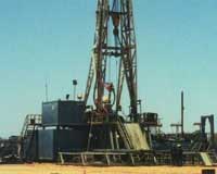
Morgan City LA (SPX) May 08, 2009 Gator Tank Rentals turned to satellite GPS and web technology to improve the tedious process of tracking thousands of pieces of expensive inventory scattered across customer locations, deepwater drilling rigs, offshore platforms, shore bases, marine vessels, and trucks. Counts were previously manual and tallied in a spreadsheet with the location of each asset being an educated guess. That was until Carter Askew, CEO of Gator Tank Rentals thought that there had to be a better way to automate the process. "I envisioned a simple, affordable tracking system to help us locate equipment, streamline our operations, and give our customers the best service in the business. I was positive that this technology would make an impact." It has. Gator can now log in to a secure web site to locate and manage thousands of pieces of equipment with the click of a mouse. Terry Daigle, General Manager of Gator Tank Rentals, knew exactly how to integrate the technology into Gator's operations. He started evaluating technology in fall of 2007 and selected Geoforce to provide the solution. "Geoforce understood our business and was able to provide custom features that we needed. I am able to log in and instantly locate our tanks and baskets sorted by asset type, customer, offshore lease block, or serial number. All of this helps us to operate more efficiently and provide better service," said Terry Daigle. Geoforce was built for the oilfield. "We are immensely honored to have been chosen by Gator for this deployment. It is a perfect example of our vision of bringing together wireless asset tracking technologies with web-based software tailored to the oilfield," said James MacLean, President of Geoforce and former Schlumberger engineer. Intrinsically safe GPS tracking devices transmit position data to secure data centers 1-4 times per day using satellite communication networks. Geoforce's web-based software does the rest. Each asset's current and historical location is shown on Google Maps along with offshore lease block information. Virtual boundaries are set to generate email alerts based on movement and inventory at multiple locations can be managed automatically. Gator also uses the software to manage lifting compliance related tasks for each asset such as mandatory visual inspections, load testing, magnetic particle inspection, etc. Shorty after the initial launch, Gator began to share access to their equipment rental customers. Gator and their customers are benefiting from the technology. Share This Article With Planet Earth
Related Links Geoforce GPS Applications, Technology and Suppliers
 Middletown RI (SPX) May 08, 2009
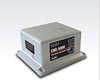
KVH Industries has announced that it has received a new $1 million order for its CNS-5000, a self-contained navigation system that combines fiber optic gyro (FOG)-based inertial measurement technology from KVH with global positioning system (GPS) technology from NovAtel. |
|
| The content herein, unless otherwise known to be public domain, are Copyright 1995-2007 - SpaceDaily.AFP and UPI Wire Stories are copyright Agence France-Presse and United Press International. ESA Portal Reports are copyright European Space Agency. All NASA sourced material is public domain. Additional copyrights may apply in whole or part to other bona fide parties. Advertising does not imply endorsement,agreement or approval of any opinions, statements or information provided by SpaceDaily on any Web page published or hosted by SpaceDaily. Privacy Statement |
 del.icio.us
 Digg
Digg Reddit
 YahooMyWeb
 Google