 |
Beijing (XNA) May 24, 2010 China is developing an independent satellie navigation system called Beidou. It's the third country after the US and Russia to have such a system developed on its own. At the first China Satellite Navigation Annual Academic Conference in Beijing, the chief designer says the system will cover the whole world by 2020 and he hopes Beidou will become the most competitive navigation system on earth. According to Sun Jiadong, the system is being completed in 3 stages. The first stage consisted of 3 satellites. It's been offering navigation services, mainly for customers in China, since 2000. The project is now in its second stage, which is to build 35 satellites to cover China and the entire Asia-Pacific region by 2012. The last stage is to offer services to customers world wide. The system provides communication services as well as navigation. The special feature has been used during rescue operations following the Wenchuan and Yushu earthquakes. Sun Jiadong, Chief Designer, Beidou Navigation System, said, "Many organizations have been using our system for a while, and they like it very much. For example, fishermen can use the system for navigation, and to send text messages to their families. All this can only happen in China." Sun Jiadong says the next 10 years is crucial for development. He hopes Beidou will become the most competitive navigation system on earth.
Source: Source: Xinhua
Share This Article With Planet Earth
Related Links - GPS Applications, Technology and Suppliers
 Kiev Says Russian Rival To GPS Good For Ukraine's Security
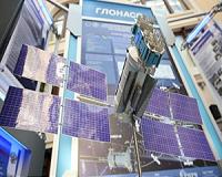
Kiev, Ukraine (RIA Novosti) May 21, 2010 Ukraine's participation in Russia's global satellite navigation project is in the country's national interest, Ukrainian Deputy Prime Minister Volodymyr Semynozhenko said on Wednesday. The GLONASS - the Global Navigation Satellite System - is the Russian equivalent of the U.S. Global Positioning System, or GPS, and is designed for both military and civilian use. Both systems allow users to ... read more |
|
| The content herein, unless otherwise known to be public domain, are Copyright 1995-2010 - SpaceDaily. AFP and UPI Wire Stories are copyright Agence France-Presse and United Press International. ESA Portal Reports are copyright European Space Agency. All NASA sourced material is public domain. Additional copyrights may apply in whole or part to other bona fide parties. Advertising does not imply endorsement,agreement or approval of any opinions, statements or information provided by SpaceDaily on any Web page published or hosted by SpaceDaily. Privacy Statement |